
Walk New Britain Streets by Address
A street directory search should begin with the address as printed, then keep each later source in its own role. MapXpress can locate the parcel and its geometry. Vision can show an owner-of-record card and a separate mailing address. RecordHub can show a deed party and legal description. A voter record, directory entry, tax account, or permit may add a dated connection, but none of those fields should be silently blended into one resident label.
Use the following street-by-street order when the goal is to understand a house, parcel, or block:
- Normalize the house number, street name, direction, street type, unit, municipality, and ZIP. Save the original spelling as well as the cleaned version.
- Run the address in Vision and record the PID, MBL, situs, owner or co-owner, mailing address, sale history, and assessment date.
- Run MapXpress with House No and Street, click the parcel, and save the MBL, lot, layers, adjacent parcels, map date, and source or edit fields.
- Use RecordHub for the current deed index and image. Work through HLR historic books when the date falls in the 1850-1958 range, since those books are not grantor-grantee indexed.
- Add the right context: SOTS or the local registrar for voter questions, MyTaxBill for fiscal clues, the Building Department for permits, and dated directories or the library for past subscribers and occupants.
New Britain Address Records Together
There is no Hartford County recorder to combine these sources for New Britain. Connecticut ended county government on October 1, 1960, and Hartford County remains a geographic subdivision. New Britain land records stay with the Town Clerk. Property, tax, building, voter, court, directory, and postal records each have a different custodian and coverage rule.
The coverage table keeps the street directory chain honest. It also shows why an online search is only one access channel when a field is missing or a record is protected.
| Record set | Keeper | Address evidence | Access and limit |
|---|---|---|---|
| Vision property card | New Britain Assessor | Owner, situs, mailing, sale, assessment, building | Free portal; owner is not proof of occupancy |
| MapXpress GIS | City GIS | House number, street, parcel, MBL, lot, layers, abutters | Free map; data nightly, maps updated July 2026 |
| RecordHub deeds and maps | Town Clerk | Grantor, grantee, legal description, book/page, map | 1958-present indexed; 1850-1958 HLR manual review |
| MyTaxBill | Tax Collector | Taxpayer, property, bill, unique ID, list number, lien context | Fiscal record; not title or occupancy proof |
| Building and permit trail | Building Department | Permit, inspection, certificate, work or project address | ViewPoint link; public result fields not captured |
| Voter records | Registrar and SOTS | Public list fields, district, registration and participation history | Privacy and redaction rules; no unrestricted block roster |
| Directories and reverse directories | Library, LOC, digital collections | Dated name, address, phone, subscriber or household clue | Runs vary; search on-site, by appointment, or online |
Keep one worksheet row per source. The same address may have a parcel situs, an owner mailing field, an old directory number, a tax property label, and a postal ZIP that do not match word for word.
New Britain Vision Search Fields
Vision is the most direct owner and parcel-card route in a New Britain street directory search. Its Property Lookup page has a Search source selector for Address, Owner, Acct#, Mblu, PID, and All. Use an address when the street number is known, an owner when the name is the anchor, and Mblu or PID when a map or prior card supplies the parcel key. Search variants matter for initials, punctuation, and old ownership names.
| Field | Type | Required or behavior | Format or note |
|---|---|---|---|
| Search source | Select | Required to choose the search mode | Address, Owner, Acct#, Mblu, PID, All |
| Address | Text | Depends on source | Enter the address used for the parcel search |
| Owner | Text | Depends on source | Use surname and known spelling variants |
| Account number | Text | Depends on source | Municipal account identifier |
| Mblu | Grouped text | Depends on source | Map, map cut, block, block cut, lot, unit, unit cut |
| PID | Text | Depends on source | Parcel ID used to narrow a result |
The sample parcel card can display location, owner or co-owner, mailing address, market value, building count, sale price, certificate, book/page, sale date, building features, assessment history, photo or sketch, and an approximate-map disclaimer. Real property is assessed at 70% of value. Current data follows the October 1, 2022 revaluation and succeeding Grand Lists through the next revaluation on October 1, 2027. It is an assessment record, not a title opinion or proof that the named owner lives at the site.
The New Britain parcel-layer record exposes the GIS field family that can be paired with a Vision card. The image below is a source capture of that parcel layer.
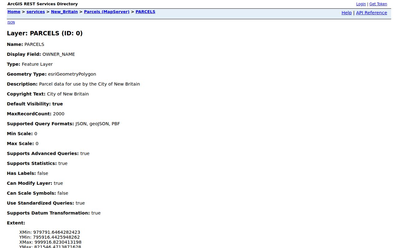
A parcel identifier is the bridge between a street search and a deed search, but the bridge must be recorded with the date and source that supplied it.
MapXpress Provenance for New Britain Streets
The New Britain MapXpress viewer accepts Name, House No, Street, and Parcel Id. Choose the street from the current list, run the address, and click the parcel rather than relying on a visual guess. The viewer can expose location, street, house number, MBL, MBL2, map, block, lot, unit, acreage, zoning, land use, sale date, sale price, tax and value fields, year built, building style, mailing address, and ZIP.
MapXpress is especially useful because its parcel provenance is visible. A record may carry SOURCE_TYPE such as deed, tax map, GPS, subdivision scan, road as-built, Department of Transportation material, commercial scan, or correspondence. EDIT_TYPE can identify a split, combination, boundary, lot, address, acreage, new parcel, attribute update, or creation. Those fields can explain why a street number or parcel shape differs across an older deed, a directory, Vision, and the current map.
The viewer lists parcel, address, lot number, utility, easement, zoning, transportation, trail, soil, water-quality, aquifer, DEEP, FEMA, and aerial layers. Sales layers are divided by Grand List Year 2021 through 2025, while aerial context includes 2012, 2019, and 2023. Property information is updated nightly and parcel maps were updated July 2026. The viewer is not a legal survey, and the city does not approve parcel shapefiles for distribution without the proper data request.
The New Britain MapXpress source page is captured below to show the map-based side of a New Britain street directory search. Read it with a Vision card and a source date.
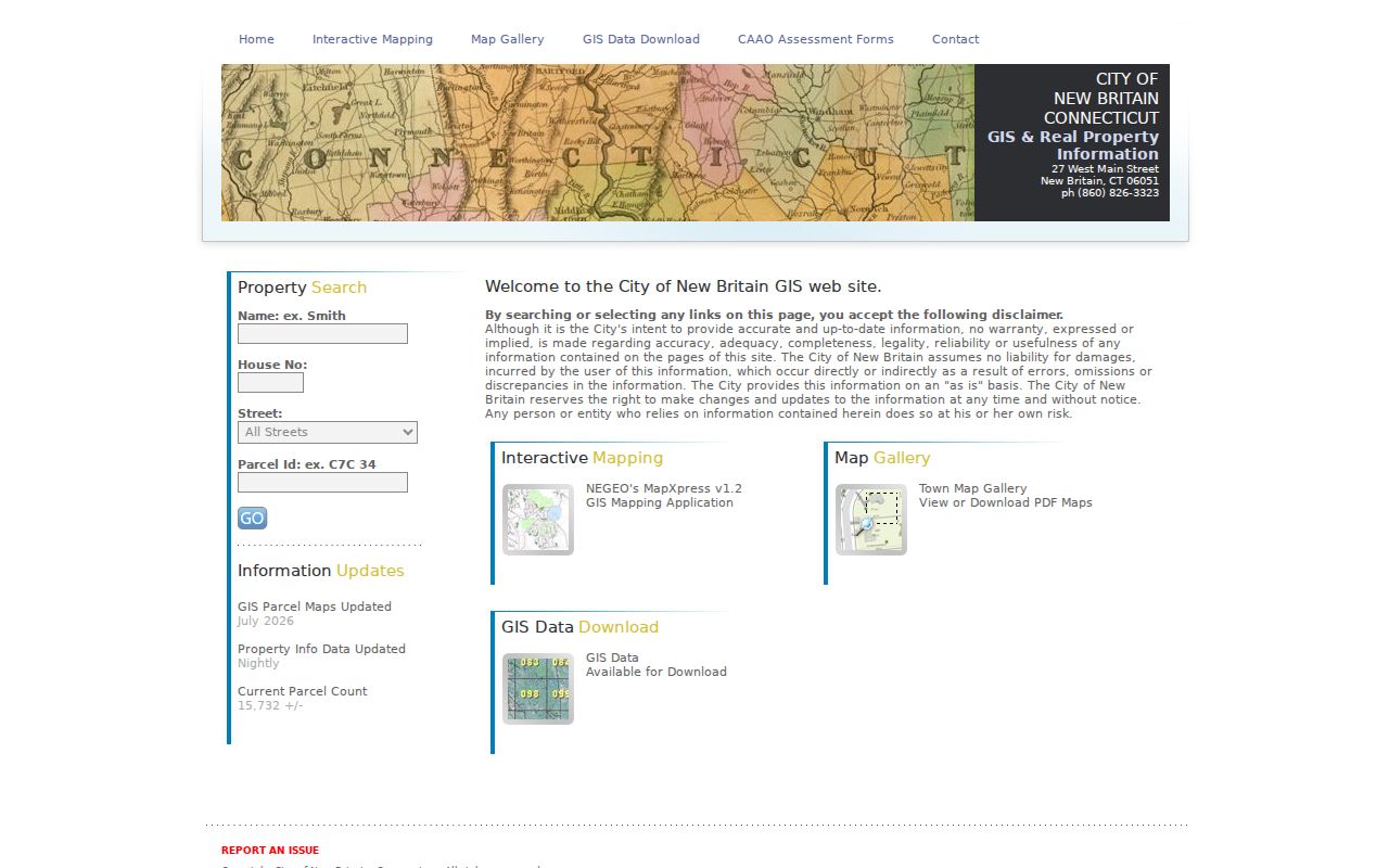
Map browse and parcel clicks are the documented public path for adjacent parcels. No dedicated numeric radius or buffer control was documented, so do not promise an automatic people-within-distance result.
New Britain Deed Chain by Street
Once Vision or MapXpress supplies an MBL, PID, lot, or legal-description clue, open New Britain RecordHub. For October 1, 1958 through the present, search the indexed land record, inspect the result, and open the image. Capture grantor, grantee, document type, recording or execution date, book/page or instrument number, consideration, legal description, map or plat, mortgage, release, assignment, lien, and marginal notation. A current owner result should be checked against the latest conveyance, not assumed from one card.
For 1850 through September 30, 1958, select HLR and review the complete historic volume. Books 1 through 54 have images, but no grantor-grantee index. Search by a known volume, page, date, lot, map, parcel, or neighboring owner. If the current street number fails, test the street spelling, former number, legal lot, map reference, and adjacent owner. The Town Clerk can help identify a page range or supply a copy.
The local land-record route includes online access, walk-in recording, e-recording, and office copies. The Town Clerk land page lists $1 per copy page and $2 for certification, while recording and map fees follow the current schedule. Walk-in recording ends 15 minutes before close, and e-recording hours are 8:30 to 3:00. A missing image should be escalated with the book, page, instrument, or HLR range rather than a vague name request.
The New Britain Town Clerk land-record page is the local instruction source. Its image below connects the street directory workflow to the actual land-record request and recording office.
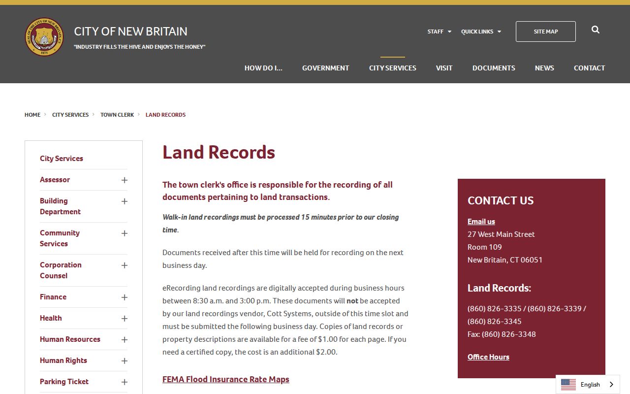
A deed chain establishes conveyances and legal descriptions. Directories and voter records may add household context, but they are separate evidence and should stay labeled as such.
MyTaxBill for a New Britain Address
The New Britain tax portal adds fiscal clues after the parcel is known. MyTaxBill can search by Name, Property Location, Bill #, Unique ID, or List Number. Name mode uses a last name plus first initial, or a business name without a comma. Property Location uses the property number or name and omits words such as Street, Court, or Lane. Bill mode uses year, type, and number fields.
Other controls can include Unique ID, Tax ID, Account ID, Link ID, DBA, and a link type such as MV or MS. Status filters include All, Due Now, Balance Due, and 2025 IRS Payment Records. The portal can supply a bill or lien-status context, not a deed, title opinion, occupancy record, or complete owner history.
New Britain lists prior-year lien assignments to ATFS, MTAG, and TaxServ for 2013 through 2020. Observed fees include $1 for a statement, $10 for payment history, $24 for a lien, $5 for a DMV report, and $20 for a returned check. Confirm the current fee before ordering. Keep the bill year, type, number, status, and search mode with the result.
The New Britain MyTaxBill source page is captured below to show the fiscal side of a street directory investigation. It should be read as an account and tax trail, not as a list of people at the address.
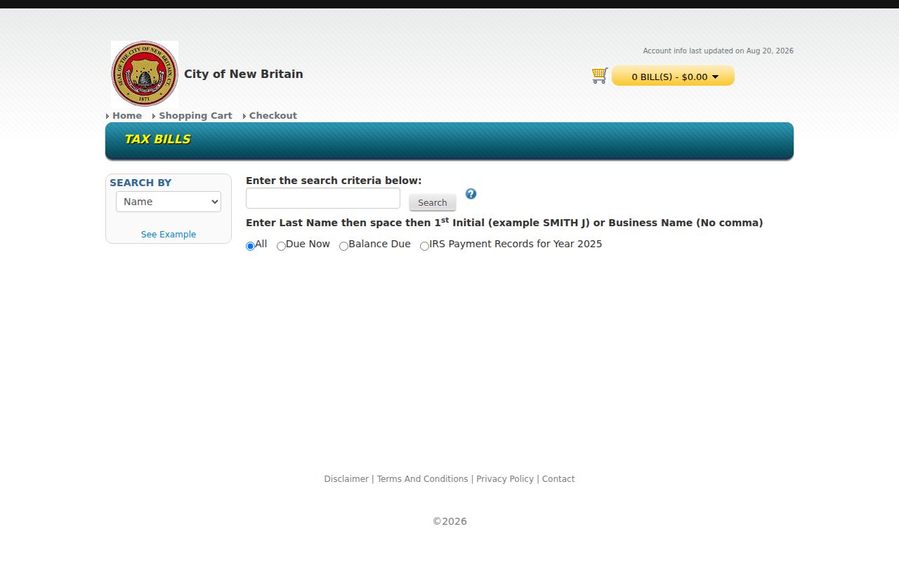
When a tax property label does not match the street spelling, return to the parcel MBL or PID and preserve both versions in the worksheet.
New Britain Permits by Address
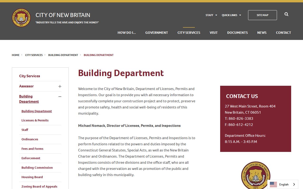
The Building Department at 27 West Main Street, Room 404, handles building and trade permits, plan review, inspections, certificates of occupancy or approval, and related records. Its published portal link is ViewPoint Cloud, but the research did not expose a public address-result screen or a complete code-case index. A street directory search should therefore treat the online application link as a route, not promise that every permit can be searched by name or number.
For an address-specific request, give the exact house number and street, parcel or MBL, date range, and record type. Ask for the permit number or type, application date, public applicant or owner fields, work description, inspection dates, certificate, and final status. The department can explain which material is available for inspection, which needs a copy request, and which exemption applies. The published phone is 860-826-3383.
Observed fee examples include $35 for the first $1,000 of project value, $25 for the second $1,000, $15 for each later $1,000, demolition at $25 per $1,000, and a $50 final reinspection fee per trade. Fees are tied to the permit or certificate, not to a resident lookup. If the public portal does not answer the address question, send a targeted request to the department or use the Connecticut FOI route for a non-exempt record.
The New Britain Building Department page is the documented public route. The image below identifies the office behind a permit or certificate trail.
A permit may name an applicant, owner, contractor, or project contact. Keep that role separate from an occupant or neighbor.
Historic New Britain Street Numbers
Street numbers are changeable research keys. The city Public Works documents include a 2022 Street Block Map, and the Library of Congress holds a 1912 “Cities of Connecticut - New Britain” map. The research did not locate a complete official online table of renamings or renumberings. A changed number should therefore be tested, not assumed. Compare the modern parcel with old deeds, maps, directory street spellings, tax cards, and neighboring lot descriptions.
When the current number produces no result, search the street without the number, then test a former spelling, cross street, map, lot, MBL, or adjacent owner. A deed may use metes and bounds or a subdivision reference. A directory may shorten the street type or omit a unit. A postal failure can reflect formatting or delivery rules, not the absence of a historic household.
New Britain's land chronology helps set expectations. The Town Clerk books begin in 1850, when New Britain became a town, and the city followed in 1871. Indexed RecordHub images begin October 1, 1958. Located directories bridge 1882-85, 1928-31, 1942-45, the 1950s-1990, and reverse examples from 1984-85, with gaps. Save each source date so a historic street observation is not mistaken for a current fact.
Reverse Directories in New Britain
A criss-cross or reverse directory turns a street directory search around. Start with house number and street, capture the listed surname, initials, telephone, year, and page, then search the alphabetical section for that person. Compare the same location across neighboring years. The entry may be a telephone subscriber or a household contact, not every person who lived at the address.
The Library of Congress guide identifies New Britain reverse-directory examples from 1984 and 1985. Earlier telephone directories, the library's printed volumes, Herald notices, and FamilySearch microfilm can fill parts of the gap. Preserve the original page image because OCR can miss initials, punctuation, Polish name spellings, apartment marks, and street abbreviations.
Use reverse directories for a dated lead, then compare the name with RecordHub, Vision, tax, census, obituary, probate, or cemetery evidence. The historical volumes and entry-reading method are developed in the New Britain Directory Book. The modern street workflow should only carry forward a name when the source date and role are clear.
The official Library of Congress criss-cross directory guide explains the address-to-name format. It is a reference for the method, not a live New Britain household roster.
New Britain ZIP Labels by Address
USPS Postal Bulletin rows document the New Britain city label for ZIP codes 06050, 06051, 06052, and 06053. The research did not locate a complete street-by-street boundary list or a definitive station assignment for each row. An address should be checked in the USPS ZIP Code Lookup, which offers ZIP by Address, ZIP by City and State, and Cities by ZIP modes.
The address form accepts an optional company, required street address, optional apartment or suite, city, state, and optional ZIP. A result does not confirm a person or company at an address. MapXpress, Vision, and MyTaxBill did not expose a reliable ZIP filter in the inspected local forms, though a parcel response can contain MAIL_ZIP after the parcel is identified.
- 06050, New Britain city label located in official postal rows; exact street assignment needs USPS verification.
- 06051, New Britain city label located in 2022 and earlier postal rows; do not infer a neighborhood boundary.
- 06052, New Britain city label located in 2022 and earlier postal rows; keep postal and parcel geography separate.
- 06053, New Britain city label located in 2022 and earlier postal rows; check the full address and unit.
A ZIP, ward, parcel, voter district, and NRZ can all describe the same street from different systems. Keep the geography label that each source actually supplies.
Terms in a New Britain Street Directory
The same word can hide a different record key. These definitions help keep a by-address result precise while moving between GIS, land, tax, and historical sources.
- Parcel
- A mapped unit of land with a municipal identifier such as an MBL or PID. One street address can relate to more than one parcel record.
- Situs address
- The physical location of the parcel. It is different from the mailing address used for an owner, agent, lender, estate, or business.
- Plat
- A recorded map or subdivision reference that can show lots, boundaries, easements, and neighboring parcels.
- Criss-cross directory
- A reverse directory that starts with an address and lists a name or telephone subscriber, usually for a dated publication year.
- Provenance
- The source and edit trail attached to a GIS field, such as a deed, tax map, GPS point, subdivision scan, or boundary update.
Save the term beside the value. “Owner mailing address,” “parcel situs,” “directory subscriber,” and “permit applicant” are not interchangeable descriptions of a resident.
Limits of a New Britain Street Directory
A street directory can show address-keyed public records, but it cannot create a complete household roster. The inspected sources do not provide a general list of household members, utility subscribers, delivery recipients, or people protected by a safety program. A directory entry may be a subscriber. A Vision card may be an owner. A voter field can be redacted or limited by law. DMV personal information is restricted under federal DPPA rules and Connecticut law.
Connecticut voter privacy and Safe at Home can suppress or substitute address fields. Conn. Gen. Stat. §1-217 protects certain officials' residential addresses. Birth and fetal-death records under 100 years have eligibility limits, and sealed or erased court material is not a general search result. If the goal shifts from a whole street to one named person, the New Britain resident lookup workflow adds same-name checks and role labels without turning an address clue into a claim.
Lawful personal use. New Britain street and address records may support family history, civic research, reconnection, and property curiosity. Do not use a name or address trail to stalk, harass, threaten, surveil, or intimidate anyone, and do not republish protected fields.
When a source is absent, blocked, stale, or outside its coverage period, mark the gap and contact the custodian. A careful New Britain street directory result states the relationship, source, date, parcel key, and remaining uncertainty.